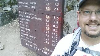
 Required Selfie Required Selfie
I awoke at about 4:30 AM and started packing up. I'd packed most of my gear the night before, and had it sitting, ready in the bear box.
I tossed my sleeping bag into the bottom of my backpack, collapsed my tent as quietly as I could, and then stacked everything on top of my sleeping bag in my backpack. My pad on the outside of my bag, I hoisted it onto my back, with my GoPro affixed to my shoulder strap, and started my 1.5 mile walk to the Happy Isles trailhead. Once I got there, a short distance across the bridge, I snapped the required selfie in front of the trailhead sign, and began the push straight up towards Nevada Falls.
I struggled mightily finding my pace, as the trail climbed 2000 feet over 2.5 miles. It took me about an hour and a half of walking to manage those 2.5 miles, and I had to make a concerted effort to both not push myself too hard, and to pause to take pictures. The views were so beautiful, and it was so nice to be away from the chaos that was the valley floor the night before.
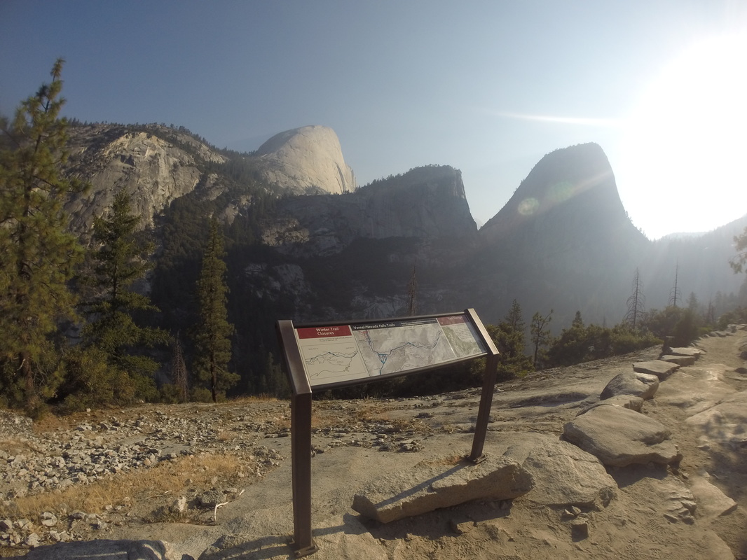
The view from Clark Point
As I walked past Clark Point, the views became more spectacular as Liberty Cap began to loom closer and closer to me.
I took the JMT route up the hill, instead of the steeper Mist Trail (looking back, I should've taken the Mist Trail, the views were probably even more spectacular, including a better view of Nevada Falls). As I rounded a bend, there was Liberty Cap, stretching up to the sky, with Nevada Falls trickling over the cliff's edge. I sat and ate breakfast at this spot, just enjoying the astonishing views.... and realizing I'd already climbed about 1500 feet, I was feeling pretty good about myself. 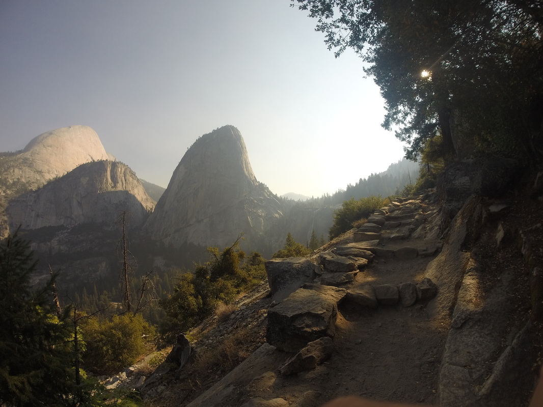
Liberty Cap & Nevada Falls
Shortly after breakfast, another mile into my walk, I got to the Nevada Falls/Panorama Trail junction. I walked the extra 1/2 mile round trip, to the Nevada Falls footbridge, and looked out over the landscape and the valley which I'd just hiked out of. The view was nothing short of incredible, although, the smoke looming over the valley was disconcerting.
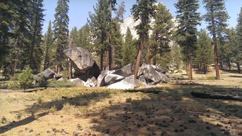 Giant Trees & Giant Rocks Giant Trees & Giant Rocks
Looking at my maps, I decided against topping off my water, seeing 4-5 streams coming in the next 4 miles, knowing that lunch would be calling my name about that time.
Continuing my climb up and out of the valley, for another mile and a half which contained another 1,000 feet of elevation gain and had me breathing heavily and questioning my own humanity as the heat of a 96 degree day beat down on me (yes, even at 7,000 feet, it was HOT). I veered off the Panorama Trail, and headed almost due south, through a burn area, which I believe was from the Hoover fire, in 2001. There was some regrowth, but nothing tall enough to give me any shade. Over the next 2.5 miles, the heat really started getting to me. With no shade, and with every stream I crossed being dry, I ran out of my 2L of water, and kept trudging on. About 7 miles into my day, I came across a tiny stream which was trickling into a couple of large pools, sat down in the shade of a burnt tree, and drank 2 liters of water, and put another 2 in my hydration bladder and soldiered on, making the mental note to not pass any water if I needed it for the rest of my trip. As I got back into the cover of the forest, my legs still felt strong, and I kept admiring just how enormous the trees were, and how much they seemed to sway with the wind. It was almost hypnotic. After crossing two more small creeks, I walked until I came upon Illilouette Creek for the first time, and found myself a decent spot to set up camp for the night, about 12 miles in. After a delicious dinner (Couscous with some packaged Chicken -- which I finished off for breakfast the next day) I was sound asleep as soon as it was dark outside. The night sky would have to wait for another night. Read On: http://www.mkehiker.com/blog/day-2-illilouette-creek-to-lower-ottoway-lake-10-miles
2 Comments
Krystle & Aaron
9/14/2015 07:16:50 pm
Hey! Aaron and I kept hoping we would bump into you on the trail. Sorry to see that you had to bail but that blister sounded pretty gnarly! We decided to push through the smoke after MTR and hurried through Forester pass, where we were told the smoke was clear. We reached Whitney on Sept. 11 and spent a few bonus days up in Yosemite and fly back home tomorrow. Stay in touch! If you reply I'll send you Aaron's email. Let us know if you're ever in the Portland or Chicago areas!
Glad you guys made it! It was a tough decision to bail, but I definitely made the right one. Turns out it was more than a blister, my foot was badly bruised and I wasn't walking normal for almost a week afterwards (even with rest!). Leave a Reply. |
AuthorKid A is an avid hiker, backpacker and outdoors enthusiast located in Milwaukee Archives
September 2016
Categories
All
|
 RSS Feed
